

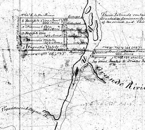
Figure 1: Original map of part of the original Soucy Concession map. Shows Tract 3 on the left with the lots pioneered by Francois and his son Augustin.
Let’s go back in time a bit – well actually back to around 1791 – and see where François and his family pioneered when they moved to the Upper St John Valley. They had felt forced out from the lands along the Hammond River where they had been settled for about 20 years, and with several other families sought land far away from the growing British influence in southern New Brunswick. Several families were granted land under what was called the Soucy Concession. Other families had recently been granted land under the Mazzerole Concession in the area where Madawaska ME is now located.
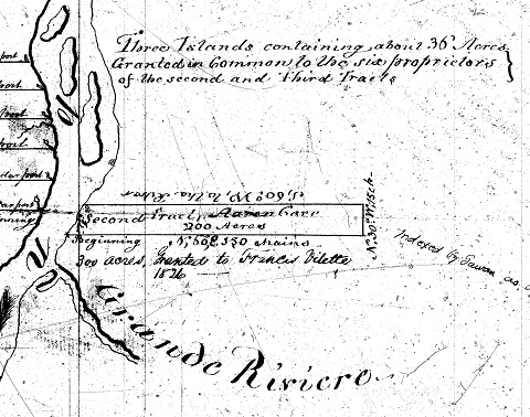
Figure 2: Tract 2 of the Soucy Concession was on the other side of the river and was granted to Aaron Cere (Cyr). Francois’ son Francois claimed 300 acres just below that along the Grand River.
The Soucy grants were scattered along the St John River from about where Lille ME is now downstream to just above the Grand Falls NB area. One group of five lots in Tract 3 were located on the south bank of the river covering the area around Keegan currently. François took Lot 1, his son Augustin took Lot 2, and three Cyr (it was spelled Cire on the maps then) family members took Lots 3 through 5. Tract 2 consisted of a single lot on the north river bank, just upstream from where the Grand River joins the St John and that was granted to Aaron Cere (Cyr). Figures 1 and 2 show the description of those Tracts and Lots from the original land grant maps.
The petitions for those grants were made in 1789, and by around 1791 those pioneers had taken possession and made the necessary improvements. They were required to pay 2 shillings per 100 acres annually (that was about one day’s wages at the time), had to erect one good dwelling of at least 20 feet by 15 feet in size, had to clear or drain 3 acres for every 50 acres of plantable land, and had to have 3 head of cattle for every 50 acres. The lots François and Augustin claimed each contained about 200 acres.
The five grantees on the south bank and the one grantee on the north bank were also granted in common the land comprising about 36 acres on the three islands in the St John River near their grants. Those islands were great for raising hay for cattle feed.

Figure 3: The Van Buren-Keegan-St Leonard area today, showing historic lot locations.
Figure 3 shows that area today. You can see that one of the three islands has disappeared. The sinuous Grand River shows clearly on the New Brunswick side. The Keegan area was built from the original François and Augustin lots, it would seem.
While the lots François and Augustin claimed were good for developing farms and cutting timber, the community had other needs. Francois claimed another parcel further south and straddling the Picquanositac Brook, which later was renamed Violette Brook. His son François also claimed a parcel on the north bank just downstream from where the Grand River enters. The Grand River is fairly flat and has little fall, but the Picquanositac has more fall and could be developed for water power. François used this to build and run a grist mill there for many years. That grist mill was still there in the 1950s. Violette Brook shows up in Figure 3 in the heart of Van Buren.
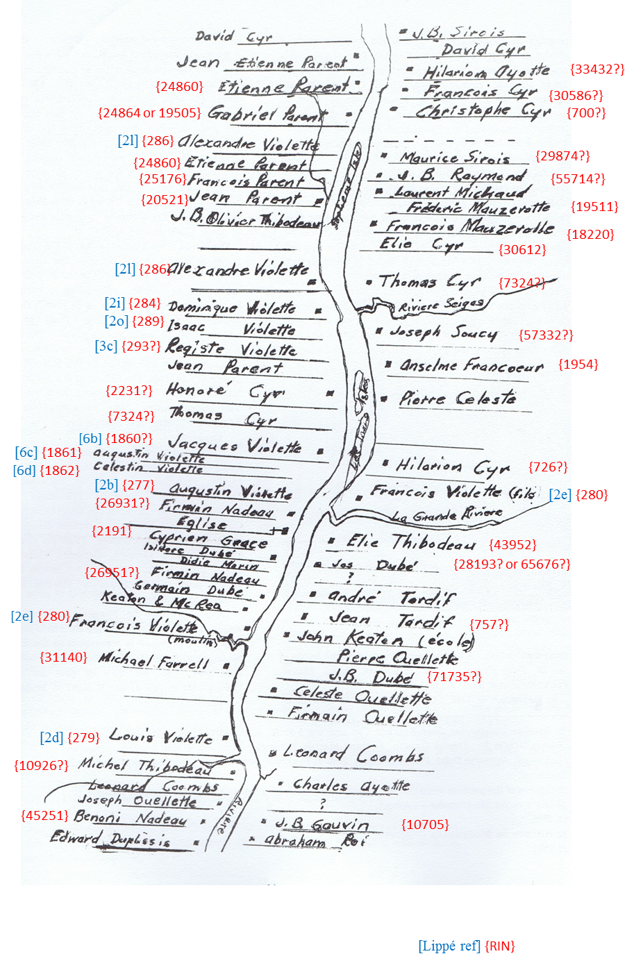
Figure 4: By 1831 there were lots more families along the river. This map was taken from the Deane & Kavanagh survey after the US-Canada boundary was settled.
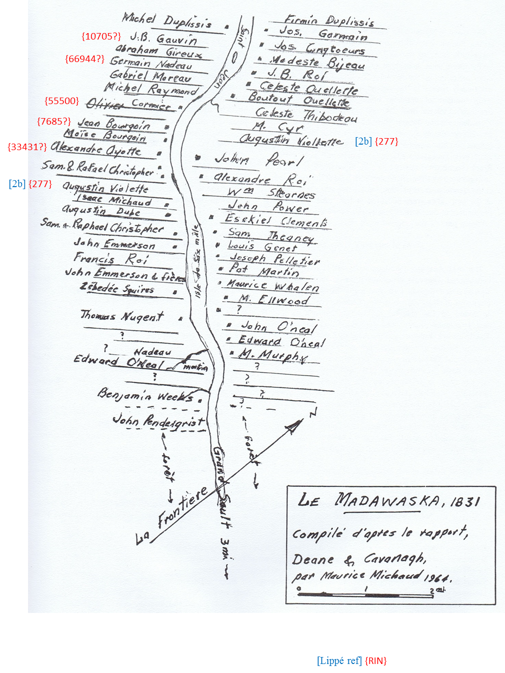
Figure 5: This is the area downstream from the map in Figure 4 and shows more of the settlers.
Forty years later there were many more settlers in the area. A survey was done in 1831, after the long border hassles finally set the border between the U. S. and Canada along the St John River. Deane and Kavanagh from Maine traveled both sides of the river and noted what families were there and were they were located. They also recorded comments about the people and history of some lots. Figures 4 and 5 show the results of Deane and Kavanagh’s work, mapped by Maurice Michaud in 1964, and published in Van Buren Maine History by Martine A. Pelletier and Monica Dionne Ferretti, 1979.
The notations in blue [] on those maps indicate that individual’s reference in the book Descendants of François Violet, published in 1984 by Rita Violette Lippé. Family [1] is François’, family [2] is Augustin’s, and so on. The notations in red {} indicate that individual’s Record Identification Number (RIN) that you will find in our genealogical database. You can look these up at our web site on the Family Tree page (VioletteFamily.org/FamilyTree). If you can trace your family tree back to one of those individuals you can see on these maps where they first lived.
Those maps were reproduced in A Violette History, by David A. Violette (VFA #621), Guy Dubay (VFA #892), and Rod Violette (VFA #12) in 2014. You can purchase this 251-page book at Amazon and all net proceeds from its sale go to the Violette Family Association. A Violette History traces the early family from Francois’ grandparents in France in 1714 through about 1831. Francois was born in 1744 and died in 1824.