We’ve been there
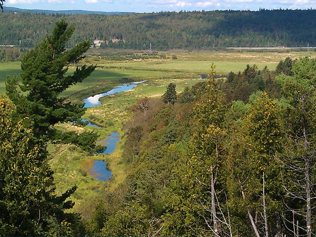
Looking down toward the Hammond River in the distance. The brook in the foreground drains into the Hammond. This was taken from the high ground above the bench where the farm buildings are located today.
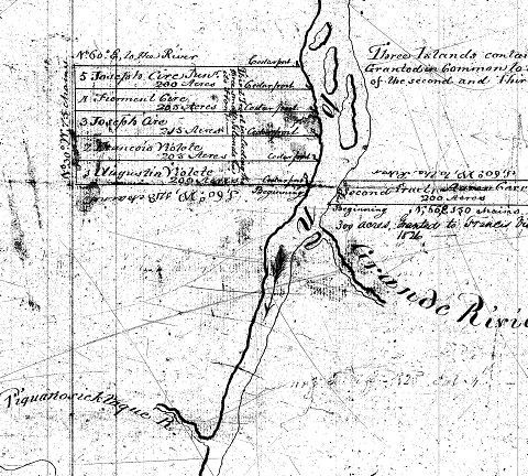
In 2011, Dave Violette, VFA #621, author of this article, visited the present-day farm that is on the lands that Francois and Marie-Luce Violet/Violette pioneered around 1769-70. They lived on that land for the next 19-20 years. The three photos here are from his visit. He got a chance to talk with Mike Steele, the current owner, and Mike gave Dave a tour of the property from the low lands along the river up into the forested high ground. Dave asked if there were any remains of the former Violette farm, but Mike said they had never found any signs of foundation or buildings. So while we don’t know just how François and Marie-Luce developed their property, from the description given here we expect that they probably built on the bench where the current farm buildings are located. Continue reading