

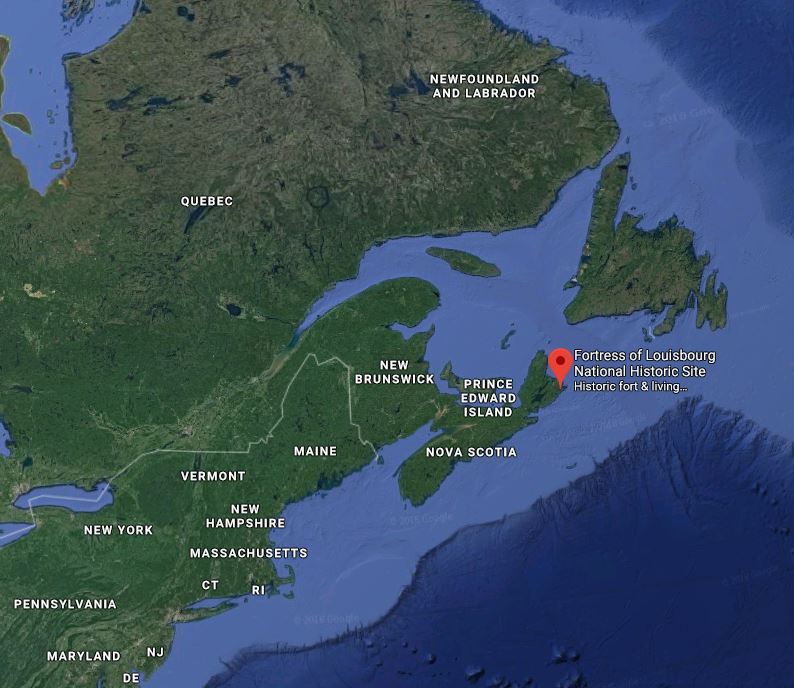
This regional view shows Fortress Louisbourg’s location on Cape Breton Island, at the tip of Nova Scotia, Canada.
This is from a visit my wife Elaine and I made to Louisbourg NS in August 2011 so I could visit Fortress Louisbourg. This place is important in the Violette family because my great-great-great-great-great grandparents, Charles and Marie David Violet, came to this fort in 1749 and thus established the Violette family on this continent. They came from France with two children: Alexis 16, and François 3. Alexis was Marie David’s child from a previous marriage. Marie David died in 1751 and Charles married Marie Anne Sudois. Charles and Marie Anne returned to France in 1758, but François, my ancestor, stayed behind as a teenager. François later moved to the St John NB area; there’s another story about that.
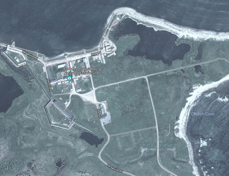
Aerial view of the reconstructed Fortress Louisbourg site today.
Fortress Louisbourg was largely abandoned after finally being destroyed in the 1760s. Parks Canada started reconstruction in the 1960s and several buildings and parts of the site have been restored, with restoration ongoing today. They used materials found at the site as much as possible and are recreating the Fortress as it was around 1744. The modern aerial view at left shows the extent of reconstruction and a closer look gives a hint of how the original was laid out. Much remains hidden.
My visit was primarily to get an idea of the whole scope of the reconstructed Louisbourg in preparation for then looking into specific aspects more deeply. I was fortunate to speak with one of the archaeological staff and she provided many insights for me after I explained my family roots in Louisbourg and why I was here.
I wanted to try to get the feel of what it might have been like for a family to live in the Louisbourg of 1749-58, to see how my ancestors might have lived. Granted, this was difficult given the relatively short time I had to spend in Louisbourg, but at least I could get some idea and maybe pass it along to you as well.
Some history
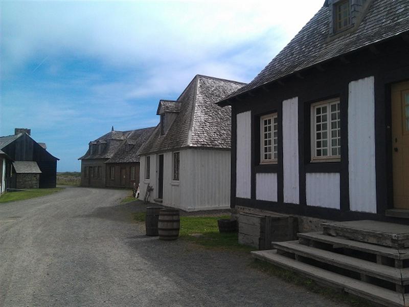
Buildings along Rue Le Quay
Louisbourg was an important port to the French because its harbor is one of the few ice-free harbors in the North Atlantic and because of the fishery resources of the region. The French also wanted to control the communication links further up the St Lawrence River to Quebec City and elsewhere, so Louisbourg’s location in the St Lawrence Gulf helped with that. Remember that being French usually meant being Roman Catholic, and that meant eating fish on Fridays. This created a tremendous demand in Europe for fish that could only be satisfied by bringing fish from the New World across the Atlantic Ocean.
Louisbourg was usually the first landfall for people coming from France, and was probably a welcome place after long weeks at sea. And for those living in Louisbourg, the arrival of ships meant news from family in France, shipments of wine and cheese and other goods not made in the area, as well as luxuries that made life more interesting and full.
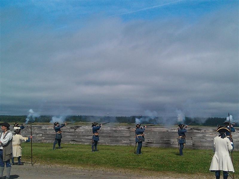
A demonstration of musketry, firing on invaders? They reloaded and fired on command and followed a long series of steps. No automatics here!
Control of Louisbourg passed back and forth between France and England in those years, and New England interests also wanted to establish a base there. The French fortified city was attacked by New England ships supported by the British in 1745 and much damage was done to both military and civilian facilities. But during a truce between 1748 and 1754 the French sought to rebuild, and the King of France offered anyone who had lived there before, plus anyone with skills needed to rebuild the city, a 150-livre incentive to move to Louisbourg and my ancestor Charles, a roofer, took up the offer and moved his family.
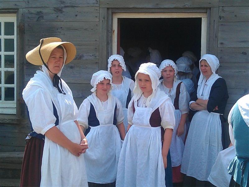
In addition to the soldiers, there are other “residents” in period dress
Louisbourg was subsequently retaken by the British and the Treaty of 1763 gave the British full possession. The British then destroyed most of what was at Louisbourg and it was not until 1961, when the Canadian government decided to restore Louisbourg, that activity in the area was regained. Today it is tourism that fuels the local economy. A new town of Louisbourg has developed further north and east along the shore of the harbor and this is where residences and businesses are now located. The former site of Fortress Louisbourg is now a Canadian National Historic Site and open to the public.
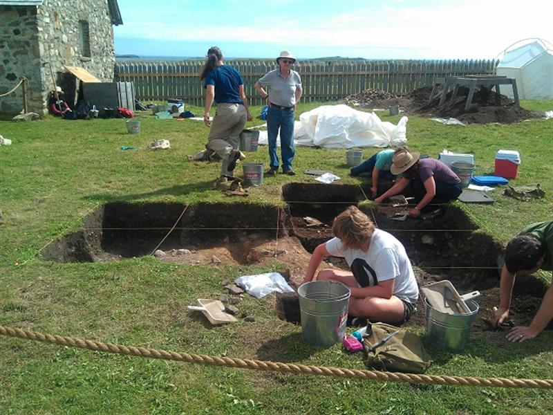
Active archaeological exploration continue at the fort
A tremendous reconstruction effort over many years has rebuilt approximately 20-25% of the original Louisbourg, primarily the quay area fronting the harbor and the the buildings nearby. The original King’s Barracks building has also been restored. The restoration work was based on drawings and documents gathered from French archives and even used some of the original materials where possible. Where new materials were used they were selected so as to be true to the original construction.
Archaeological research and excavations have discovered where those buildings where constructed and reconstruction has placed them in the exact location they were previously. The Parks web site reports that “750,000 pages of documents and 500 maps and plans have been copied from archives in France, England, Scotland, the United States and Canada. The historical evidence reveals much about life at Louisbourg and provides an excellent base for the study of the French in North America.”
While Louisbourg started as a fishing village with a few residents, when the King decided to improve upon it it became a planned city in all regards and while individuals could decide what they wished to construct and where, the location of buildings was highly controlled. Buildings had to be constructed right up to the lot lines, not set back from the street. If a building were discovered to not be constructed in the proper location it was required to be removed and restarted properly. One of the highest positions in the city was that of the Engineer, and M. Verrier lived in one of the best houses in town. In fact, many resented that his house was better than theirs!
Louisbourg life was a mix of civilian and military. The prime reason for Louisbourg’s existence was the cod fishery, which brought much wealth into the King’s coffers as well as to those for whom it was a business. Louisbourg’s location at the mouth of the Gulf of St Lawrence also provided a military base for protection of the important communication and commerce route with France’s holdings further up the St Lawrence, in Quebec and Montreal and other places. So there was a large military contingent based in Louisbourg and extensive fortifications were built to help protect the city.
While there was some agriculture in the area to support the population, which varied from about 2,000 to as many as 8,000 at times, Louisbourg also had to depend on agriculture in nearby French-held Ile Saint Jean (now Prince Edward Island) as well as agriculture on Ile Royale (Cape Breton Island, where Louisbourg is located). They probably also depended on agriculture in Acadia, as the neighboring peninsula was known; Acadia and Ile Royale together today make up Nova Scotia. And, there is no question that much was imported directly from France – perhaps some food items but most certainly manufactured and commercial goods. The archaeological exploration in Louisbourg has found many examples of items of French manufacture, along with those of British origins from British occupations. So the fact that Louisbourg’s harbor was mostly ice-free was extremely important.