

We’ve been there
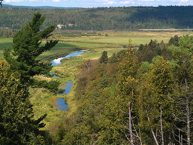
Looking down toward the Hammond River in the distance. The brook in the foreground drains into the Hammond. This was taken from the high ground above the bench where the farm buildings are located today.
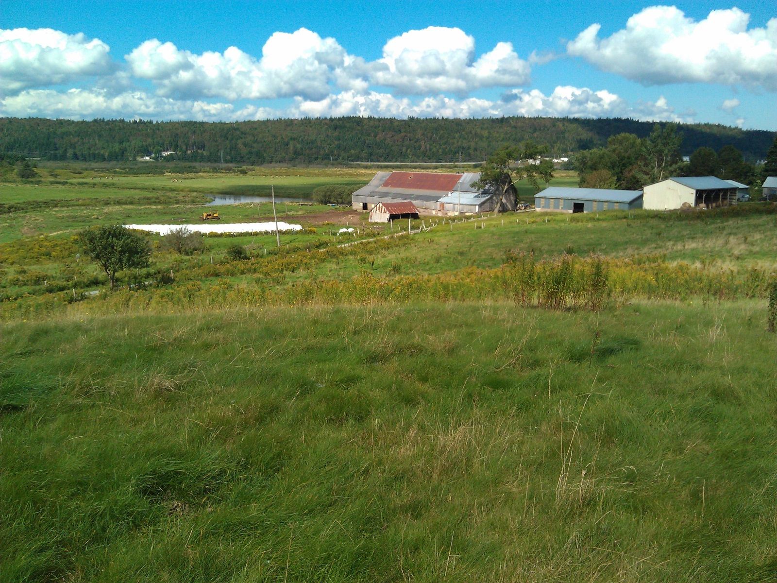
In 2011, Dave Violette, VFA #621, author of this article, visited the present-day farm that is on the lands that Francois and Marie-Luce Violet/Violette pioneered around 1769-70. They lived on that land for the next 19-20 years. The three photos here are from his visit. He got a chance to talk with Mike Steele, the current owner, and Mike gave Dave a tour of the property from the low lands along the river up into the forested high ground. Dave asked if there were any remains of the former Violette farm, but Mike said they had never found any signs of foundation or buildings. So while we don’t know just how François and Marie-Luce developed their property, from the description given here we expect that they probably built on the bench where the current farm buildings are located.
The farm setting, with buildings above the river flood plain and high pasture. The Hammond flows toward the west edge of this view; the brook at left drains into the Hammond
Their land was well chosen for its features. The river frontage not only gave them access to water for domestic and farm use, it also provided a transportation route in the days before roads were built. Those lands along the river are excellent for growing hay and other crops and the soils are rich.
Just beyond those river lands is a bench on higher ground which provided protection from river flooding. These land are better drained and very suitable for buildings and stables and fenced areas.
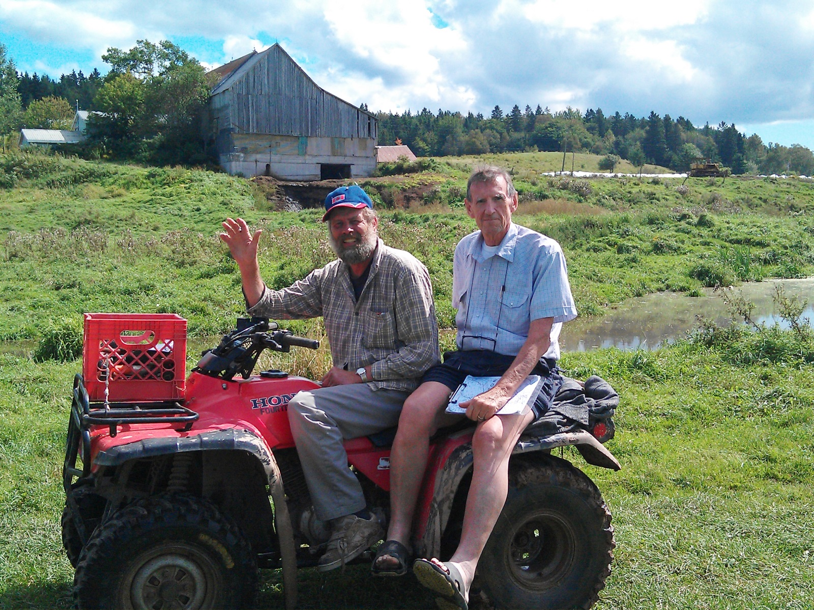
Mike Steele with Dave Violette. Mike is the current owner of the farm and gave Dave a long tour of the former Violette property.
Above the bench the land rises more steeply and the lands are heavily wooded. Those trees on the bench and above provided a source of timber for construction as well as for domestic use.
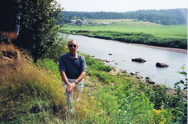
Rod Violette, VFA#12, along the Hammond River with the Violette lands in the background. 2002.
Rod Violette, VFA #12, visited the area in 2002 and explored the Hammond River as well as the French Village downstream. The photo shows Rod and was taken from across the Hammond looking toward the lands François and Marie-Luce had pioneered. The lower lands closer to the river in this view were not part of their holdings, however.
Some history
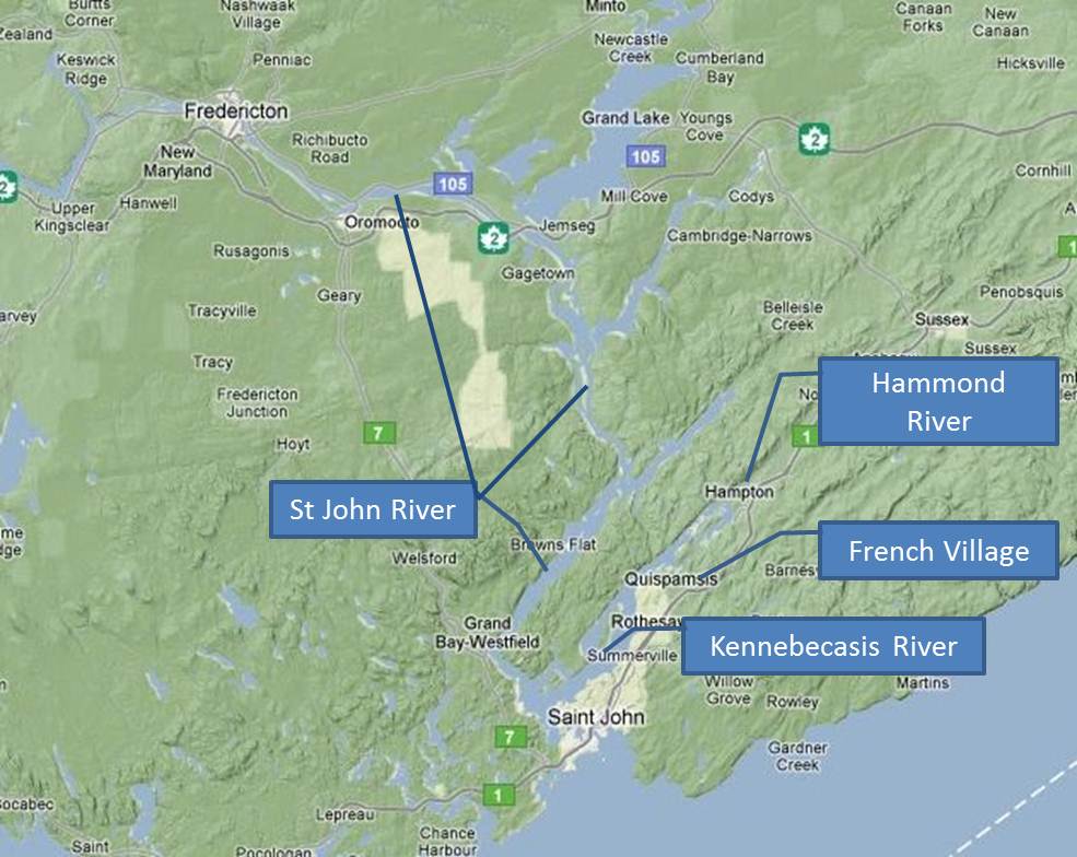
Rivers in the St John NB area
François Violet/Violette and other Acadians made their way to the town of St John, in what would become New Brunswick, around 1769 along the St John River and he may have lived there for a while. But eventually he and others settled on the Hammond River, also called the Little Kennebecasis. The lower St John River area was receiving increasing interest by British subjects as more and more moved to the continent and came to the region. Monckton, Hazen, and Studholm had conducted raids along the St John between 1758 and 1763 to rid the area of French and Acadian settlers in order to make room for the Loyalists moving in, even before the Treaty of Paris (1763). We think that the Acadians settled along the Hammond River because it was off the beaten track, and the raiders of the St John River settlements never mentioned the settlers on the Hammond River. These raids were not just minor harassments: they were meant to destroy all property, both houses and animals, and, in some cases, resulted in the loss of life of the settlers.
François and Marie children born at Hammond River
This part of the lower St John River area had a strong historical French presence and influence for many years before François and the other Acadian families decided to move into the area. A grant from the French crown was made to Pierre Chesnet, Ecuyer, Sieur de Breuil in 1689 which included lands on both sides of the Hammond River. By the time François and Marie-Luce were married in 1770, 61 Acadian families totaling 341 people had moved into the Hammond River area, though we do not think that they had title to their land from the French seigneurs. Those seigneurs had largely not sought to develop their holdings. The French Village settlement was probably formed in 1767, which was almost 80 years after the French land grants were made
Soon after the Treaty of Paris, pre-Loyalist British started moving into the area around the Bay of Fundy. By the spring of 1764 Simonds, Hazen, and White established their trading post at the mouth of the St John River and others settled further up the river. Oromocto was established as the shire town of Sunbury County in 1765 and by 1768 the British removed all the Acadians from along the St John River up to Sainte-Anne de Pays-Bas (Fredericton). These Acadians were chased off their land. Some went to Québec and some to the Miramichi area. But some families had chosen to move down to the Hammond River area where they probably felt safe from British raids since this took them away from the St John River and its major tributary the Kennebecasis. Both of those were accessible by British ships whereas the Hammond River was not.
In 1782 the lands of the earlier de Pienne and de Breuil French seigneuries were granted to Sir Andrew Snape Hammond, the Lt. Governor of Nova Scotia, and new lots were defined and surveyed. These new lots probably generally followed the layout of the earlier lots with short frontages along the river and great depths away from the river. This arrangement made sense since access to the rivers was important for travel and communication.
At the time of the Hammond grant mention was made that the land grant included a French settlement of fifteen families that had been there since 1768. The list included the names Thibodeau and Violet/Violette.
Matters were made worse for the Acadian settlers during and after the American Revolution, as British Loyalists in the U.S.A, that had now become an independent country and were no longer British colonies, fled New England for British lands in the north. The British crown made many land grants so that their subjects could have land to own and build on, and the earlier French land grants were abandoned or ignored.
The accommodation between English merchants and French settlers proved to have been more easily reached than that of new subjects as land settlers. There was already well documented accommodation between merchants and French clients by 1782 but it would take another five years for the New Brunswick government to first define itself, and then get on in resolving the settler’s claims. François Violet would then acquire actual title to what came to be called Lot 14 on the Hammond River of the Kennebecasis valley in 1787.
François and Marie-Luce’s farm
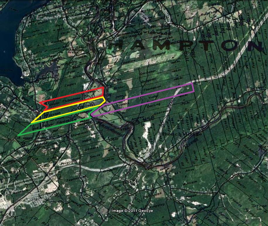
Lots along Hammond River. Lot 14 (violet outline, east side) is labeled “Francis Violet, 210ac”, Lot 12 (red outline, west side) is labeled “Olivier Thibodeau, Sr, 120 ac; Lot 13 (yellow outline, west side) is labeled “Joseph Terrieau, 133ac”; Lot 14 (green outline, west side) is labeled “J Terrieau & Olivier Tibideau, 160 ac”. (overlaid on Google Earth image)
Fortunately, two influential Loyalists, Edward Winslow and Ward Chipman, took up the cause of the Acadians and obtained, from the government, the restoration of some of their property. On April 12, 1787, grants of land were made to fifteen Acadians and twenty seven Loyalists. The lots were awarded such that the Acadians were dispersed among the Loyalists. François was awarded lot # 14 on the east bank, consisting of 210 acres. The subdivision into lots shown in in the map at right was not from the original French grants but from the British grants to Sir Andrew Snape Hammond. Notice also in that map the holdings of other family members on the west bank: Olivier Thibodeau, Sr, Marie-Luce’s older brother, held Lot 12 (red); Joseph Terrieau (Theriault), married to Marie-Luce’s older sister, Marie-Madeleine, held Lot 13 (yellow); and Olivier Thibodeau, Sr, and Joseph Theriault together held Lot 14 (green; on the west bank) – immediately across the Hammond River from François and Marie-Luce.
By 1786, François and Marie-Luce had lived on their lands for about 16 years and their farm and holdings were well established. Their first 12 children were born in that place. They had lots of family support with relatives living nearby across the river.
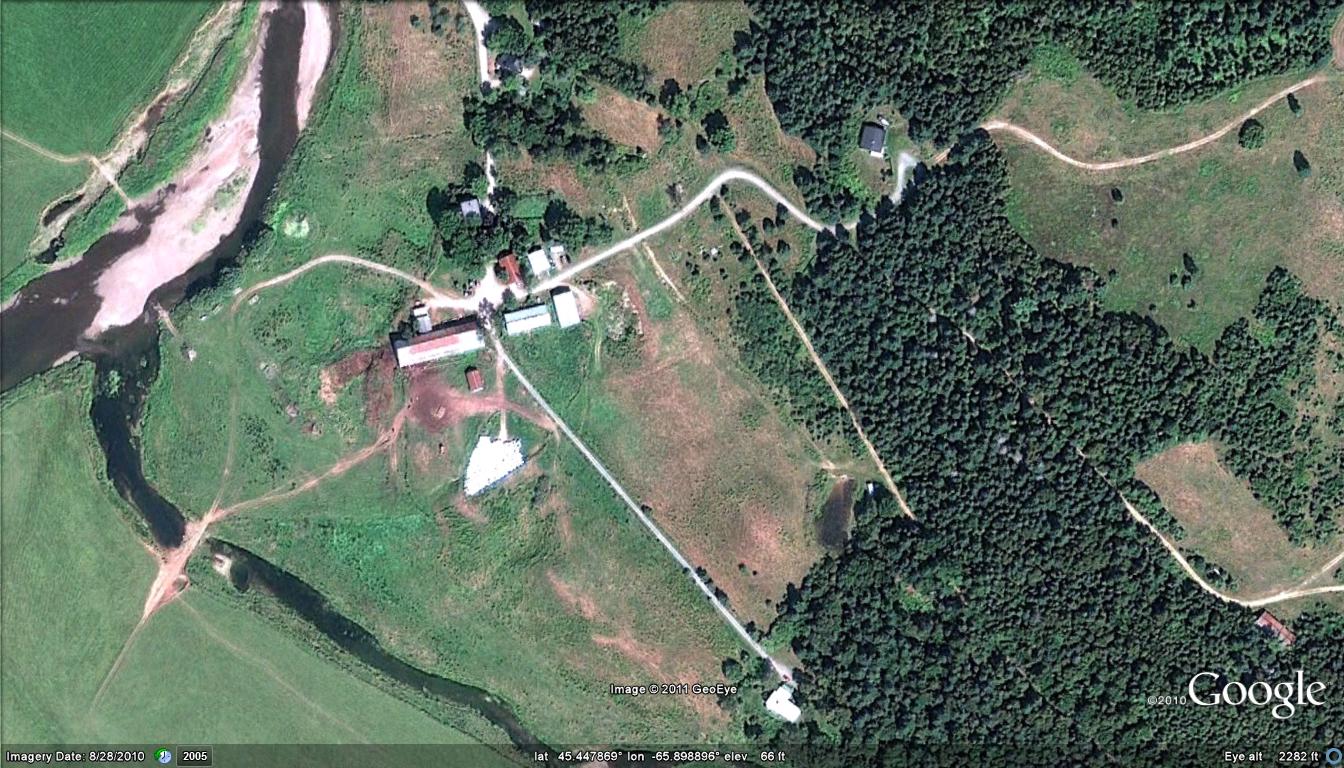
The Violette farm lands today, in aerial view. No Violette buildings remain. The stream in the lower left is a brook tributary to the Hammond River, which crosses in upper left.
The turmoil would become too great for those pioneer families, though, and by 1789 they petitioned for land grants way up the St John River, in present Van Buren ME and St Leonard NB.